cSurvey

  • Increase font size
  • Default font size
  • Decrease font size
History

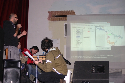
XXII Congresso Nazionale di Speleologia

Al XXII Congresso Nazionale di Speleologia è stato presentato un 'esperimento' di integrazione tra cSurvey è il portale di gestione del catasto grotte dell'Emilia-Romagna.
Un grandissimo ringraziamento a tutta l'organizzazione per la bellissima esperienza.


04/10/2013

BugFix:

  • fixed many bugs on station's grid;
  • corretto bug nella gestione degli sketch che ne causava la scomparsa subito dopo l'inserimento;
  • fixed bug on sketch (sketch disappearing after adding);
  • changed the rock/concretion/sing gallery for some multithreading issue;
  • fixed object flipping;
  • fixed many minor bugs.

Implementation:

  • added UTM coordinate for station;
  • added new Loch data selection form;
  • new KML exportation function with more compatibility with QGis;
  • Removed PCX format from track exporting.
 

26/09/2013

BugFix:

  • fixed many application crashes with new multithreading functions;
  • fixed many minor bug in design;
  • fixed bugs in stations grid;
  • fixed bugs in TH2 import and with the "cleaning points" internal function;
  • fixed many minor bugs.

Implementations:

  • many new splay function in extended elevation view;
  • new 'merge' function to combine many selected object in one.
 

16/09/2013


Foto: CNSS SSI

Il weekend appena terminato ha visto svolgersi, ad Altamura (BA), un corso di II° livello SSI sull'utilizzo di cSurvey.
Bellissima esperienza sia per l'ottima organizzazione sia per la partecipazione numerosa, attenta ed estremamente preparata.
Nuovi spunti e suggerimenti sono ora in cantiere.
Ovviamente un grazie vivissimo a tutti!

Qui il resoconto dell'iniziativa.


10/09/2013

BugFix:

  • fixed many bugs raising when working with not italian language;
  • fixed bugs on svg exporting;
  • fixed bugs on VisualTopo exporting;
  • many minor bugs fixed.

Implementazioni:

  • add design pan with the mouse's middle button;
  • added support for additional measure unit for distance,  bearing and inclination. The default unit for the designer still remain meters;
  • enabled an options to send Loch the cave borders for 3D model.


Page 9 of 20


Questions? Bugs? suggestions?
Take a look at forum
Sorry, most topic are in italian but you are free to write also in english...